
Walk a Springdale Street
A sound Springdale street directory search moves from location to document. Start with the exact address as used today, including a directional prefix, street type, or unit. Springdale GIS can identify the incorporated municipality, county, postal community, ZIP, and E911 jurisdiction. Once the county is clear, the assessor supplies the parcel and titled owner. That owner name and legal description lead to the circuit clerk's deed index.
Residency needs more care. A tax-mailing address may differ from the physical site. A recorded owner may be a trust or business. VoterView checks one known person rather than listing a street. Criss-cross directories can name past occupants by house number, but they belong to a stated publication year.
- Resolve the address and county in Springdale GIS or a county parcel viewer.
- Open the proper assessor record and capture parcel, situs, mailing address, owner, and legal description.
- Use the parcel or legal description to find the acquisition deed and prior owners.
- Verify a known voter only through VoterView, respecting protected addresses and the tool's limits.
- Use permits, maps, and criss-cross volumes to add dated address evidence without calling every named owner a resident.
Split Springdale Streets by County
Springdale's Washington-Benton county line is the first street-directory filter. Historic and central parts of Springdale are largely in Washington County. Northern and western annexations reach Benton County. Yet neither a familiar street name nor a `SPRINGDALE` postal line proves which county has custody. The city address layer keeps separate `county`, `inc_muni`, `juris911`, `post_comm`, and `post_code` fields because those boundaries serve different public tasks.
Some incorporated Springdale points use ZIP 72745 and can show Lowell as the postal community. Other Springdale addresses in 72762 and 72764 occur in both counties. Use the parcel boundary or county field, not the ZIP alone. Then choose the matching assessor, GIS, recorder, tax, and election system. That one step prevents many false “no record” results.
Open the Springdale GIS services that support the city and county check shown here.
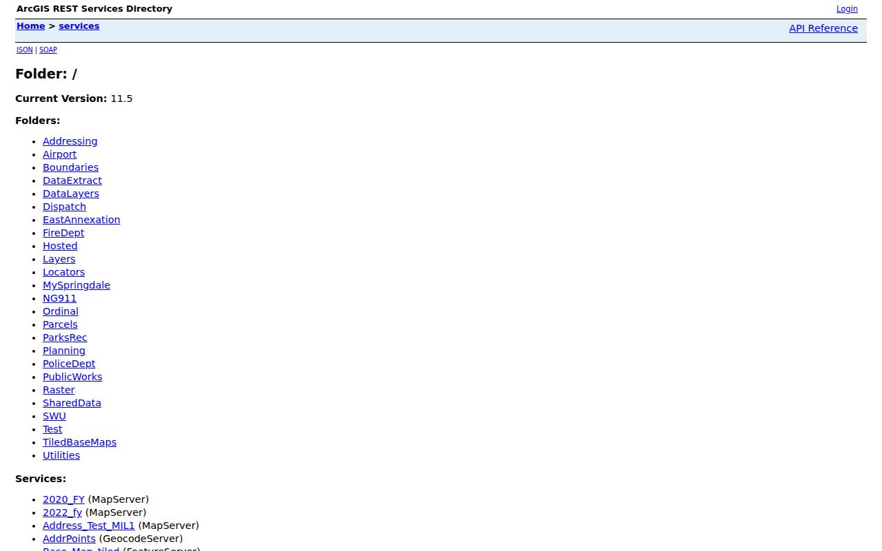
The service catalog exposes the official address, centerline, and city-limit layers used to place a street before entering county records.
Note: Postal city, ZIP, county, incorporated limits, and E911 jurisdiction may all describe the same address in different ways.
Search Springdale Street Address Fields
Washington County says property can be searched by owner, address, or parcel and provides DataScout and a public webmap. Call the assessor at 479-444-1500 when a spelling, parcel, or address does not resolve. Benton County Property Information uses one combined field for an owner name, address, or parcel ID. Its result can show ownership, acreage, current deed, survey plats, elected districts, and school district.
| Field label | Input type | Required | Springdale use |
|---|---|---|---|
| Enter Name, Address, or Parcel ID | Combined text with suggestions | Yes, to search | Find a Benton County parcel by any one known key |
Try the complete street type and directional, then a plainer form if needed. Do not invent a parcel ID. A good Springdale street directory entry records the search form that worked, because punctuation and abbreviations can vary across assessor, GIS, and recorder systems.
Visit Washington County DataScout before comparing the live property search with this capture.
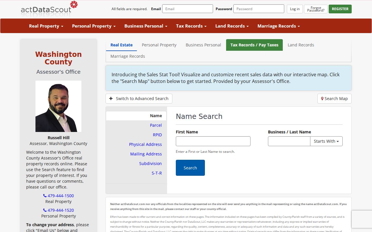
The Washington search is the correct assessor path after GIS places the Springdale address on the Washington side.
Visit Benton County DataScout for the second county's property interface.
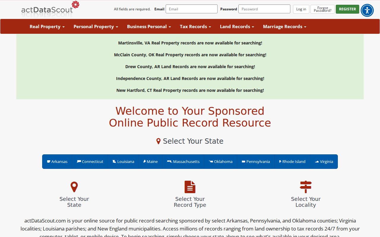
The Benton capture shows why north Springdale addresses need a separate county search instead of a repeat query in Washington County.
Springdale Street Record Coverage
Each address-keyed record contributes a different layer. The assessor is the current ownership anchor. GIS establishes place and parcel shape. The recorder supplies transactions and encumbrances. Springdale Building files can document work at a chosen site. Historical maps and directories add past context. A voter tool verifies an individual but does not produce a street roll.
| Address record | Keeper | What it adds by street | Access path |
|---|---|---|---|
| Assessment roll | Washington or Benton Assessor | Owner, situs, mailing, legal description, value and homestead | Public search; assessor phone or counter fallback |
| Parcel GIS | City and correct county | Parcel placement, nearby lots, county and street context | Public viewer and map services |
| Recorded land files | Correct circuit clerk | Grantor, grantee, deeds, liens, plats and covenants | Online index, paid images, clerk counter, mail |
| Building permits | Springdale Building Department | Permit type, address, applicant, owner or contractor when public | Department or focused FOIA request |
| Historic address sources | Shiloh Museum and Library of Congress | Past occupant clues and mapped building footprints | Research appointment, remote help, or digital maps |
| Voter verification | Arkansas and county election offices | Known individual's registration facts | VoterView; not a street browse |
Chain the rows rather than treating them as interchangeable. Parcel number and legal description bridge the assessor to the deed. A dated permit can explain an improvement. A historical directory can add an occupant who never held title.
Read Springdale Street Parcel Cards
Benton real-estate records document current ownership, legal description, situs, mailing address, deed transfers, land and building data, valuation, assessment history, and homestead status. Benton GIS adds parcel ID, acreage, current deed, survey plats, and government or school districts. Washington maintains comparable core parcel records and reappraises real estate every four years, adding new construction each year.
The situs is the assessed physical location. The mailing address is the destination for tax correspondence. A legal description identifies the land through lot, block, subdivision, section-township-range, or metes and bounds. A plat is a recorded map of lots or subdivisions. These fields help link records even when a street label changes.
- Parcel
- A mapped unit of land tied to an assessor identifier.
- Situs address
- The parcel's assessed physical location, distinct from tax mail.
- Plat
- A recorded map that defines lots, blocks, and related land features.
- Criss-cross directory
- A dated directory arranged by street and house number for reverse searching.
Homestead status can support the idea that an owner occupies a site, but it never names every person at the address. Apartments, condominium interests, trusts, and business-owned parcels require still more care.
Browse Springdale Streets in GIS
Benton Basemap offers Search, Query, Layers, Measure, Draw, Plat, Advanced, and Spatial tools. Official instructions begin with an address search. Select the result row, open Spatial, choose Parcels under “Select Features In,” and use “Intersect By.” The result identifies the parcel containing the address point. Zooming, drawing, and measuring can help define a block, but the map does not advertise a one-click residents report.
Springdale centerlines make a true street-by-street review possible. They hold left and right address ranges and parity values of Odd, Even, or Both, plus postal community, ZIP, county, E911 jurisdiction, road class, design, and surface. This data shows which numbers belong to a segment. It still does not name a household. Washington County provides DataScout and a public webmap, with the assessor as the fallback when the map cannot resolve a parcel.
Note: County maps are reference tools, not surveys or title opinions; verify legal boundaries in recorded plats and instruments.
Build Springdale Street Deed Chains
After the parcel card, retrieve the current acquisition deed. Capture the grantor, grantee, date, instrument or book and page, legal description, and any cited prior instrument. Then search the seller as an earlier grantee. Confirm each step with the same legal description because name matches alone can jump to unrelated land.
Washington County offers a historical search covering 1834 through 1991 plus a current indexed route. The county also permits in-person and mail or package research. Benton County's public deed index begins May 3, 1945, with deed images from January 31, 1933. Before October 30, 2017, use book and page; newer instrument numbers start with “L.” Benton supplies fee-based images and in-person research at the recorder's Bentonville counter. Earlier books remain the fallback.
This is where a whole-street search becomes evidence rather than a list. Repeat the same parcel-to-deed method for each selected parcel, keeping lot and block data stable. Recorded plats, mortgages, releases, liens, and protective covenants can explain parcel changes and association names.
Springdale Street Permits by Address
Springdale Building Department issues building, electrical, mechanical, plumbing, sign, moving, demolition, and garage-sale permits, plus certificates of occupancy. These files can date work and may identify an applicant, contractor, or owner. No verified public historical permit-search portal or start year was found. The access chain therefore begins with the department or City Clerk at 201 Spring Street, 479-750-8154, on weekdays from 8 a.m. to 5 p.m.
Ask for existing address-specific index entries and final certificates within a narrow date range. Inspection requests themselves use a name, phone, inspection address, inspection type, permit number, requested weekday, and morning or afternoon preference. Washington County does not require a building permit for certain agricultural buildings, single-family homes, or residential accessory structures in unincorporated areas, though other rules may apply. A missing permit is not proof that no work occurred.
Review Springdale's written records-request channel alongside the captured request page.
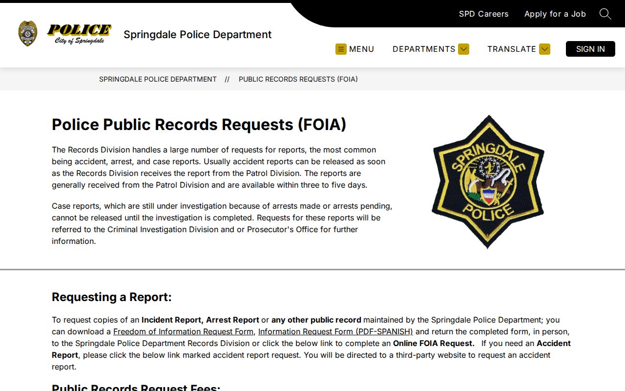
The request route illustrates the offline fallback needed when Springdale address files have no public historical search screen.
Bridge Old Springdale Streets
Springdale's GIS schema preserves current and legacy street components. If an old address fails, note the former direction, type, or name and search both versions. Then use the legal description or plat as the continuity anchor. No authoritative source identified one citywide Springdale renumbering year, so a researcher should not invent one or assume every house number shifted at once.
The November 1924 Sanborn edition supplies an eight-sheet checkpoint for buildings and blocks. It rarely names the occupant, but it can show a footprint, use, material, and street context. Pair it with a dated directory, census entry, deed, and plat. Shiloh Museum's directory holdings include a 1908 Springdale volume, telephone books from 1920, and later publisher series through 2016. The historical shelf belongs in depth on the Springdale directory book page; here, the criss-cross function matters because it reads an address back to a listed occupant.
Springdale Street Voters Are Not Rows
VoterView verifies one individual's registration and polling information when the required identifying facts are known. It does not let a visitor type a street and retrieve everyone along it. Actual residence decides Washington or Benton County election custody, while ownership does not establish voting residence. A Springdale postal address alone cannot settle the county.
Arkansas law requires secure-voter addresses to be removed from computerized lists. Other public voter data may include a name, nonprotected address, ZIP, precinct, and status, but ballot selections are never public. A failed lookup can reflect spelling, county boundaries, a recent change, or protected status. Street-directory claims must not turn that absence into a claim of nonresidence.
Note: Use voter records to test a known person's registration, never to manufacture a household or street roster.
Springdale Street Directory Limits
A Springdale street directory built from official records can show titled owners, parcels, grantors and grantees, public permit parties, and dated directory entries. It cannot supply a complete current list of renters, children, guests, or other household members. Utility subscribers, student records, delivery data, and motor-vehicle addresses are not substitute public directories. Homestead status is only a clue. A mailing address may point away from the parcel.
Maps can also mislead when read too broadly. An address point is not a parcel boundary. A parcel owner is not automatically a resident. A nearby lot is not necessarily part of the same block, and a condominium may have distinct interests. Describe results precisely: “owner of the parcel,” “party named in the deed,” or “listed occupant in the 1974 directory.” Date each claim.
Lawful use. Springdale address records are for legitimate personal research; never use them to stalk, harass, intimidate, or evade a protected address.